Seismic Shockwaves Shake Florida as Experts Evaluate Cuba Earthquake Tsunami Threat
National Weather Service and USGS Confirm 6.1 Magnitude Marine Quake Triggers Peninsula Tremors with Zero Coastal Threat

Earthquakes and Florida Peninsula Tsunami Emergency Alerts
The activation of Florida peninsula tsunami emergency alerts depends on continuous monitoring of tectonic activities across the Caribbean plate boundary, particularly along the northern coast of Cuba. While the Florida landmass rests on a stable carbonate platform with exceptionally low local seismicity, its extensive coastline remains vulnerable to distant underwater movements that can trigger maritime disturbances. Understanding the structural relationships between regional Caribbean fault systems and local coastal warning networks provides the foundation for effective emergency planning along the southeastern United States. Marine safety agencies analyze seismic signatures to evaluate whether distant geological displacements present true risks to local coastlines or simply require standard observational tracking.
The National Oceanic and Atmospheric Administration (NOAA) oversees the primary monitoring infrastructure through the National Tsunami Warning Center (NTWC), which coordinates directly with localized weather forecast offices. When a significant underwater seismic event occurs in the Caribbean Sea, automatic data streams transmit wave gauge readings and deep-ocean pressure sensor metrics to determine if a displacement wave has formed. Local emergency managers utilize these incoming metrics to decide whether to issue coastal notices, ensure harbor clearings, or initiate inland evacuation procedures. Because seconds matter during major oceanic disruptions, maintaining clear, non-alarmist communication paths between data centers and coastal populations is necessary for preventing panic while maximizing public safety.
Tectonic Mechanics of the Caribbean Plate Boundary
The primary driver of seismic energy capable of affecting the southeastern United States is the complex boundary separating the North American Plate from the Caribbean Plate. This zone features a series of major strike-slip faults and subduction trenches, most notably the Cayman Trough and the Oriente Fault Zone running just south of Cuba. When stress accumulates along these tectonic borders and releases suddenly, the resulting energy propagates through the ocean floor, creating waves that travel across deep water basins toward the Gulf of Mexico and the Atlantic Ocean.
+-------------------------------------------------------------------------+
|                  REGIONAL TECTONIC MECHANICS OVERVIEW                   |
+-------------------------------------------------------------------------+
| NORTH AMERICAN PLATE (Moves relatively Westward / Southward)             |
|   v v v v v v v v v v v v v v v v v v v v v v v v v v v v v v v v v v v |
| ===================== ORIENTE FAULT ZONE (Strike-Slip) ================ |
|   ^ ^ ^ ^ ^ ^ ^ ^ ^ ^ ^ ^ ^ ^ ^ ^ ^ ^ ^ ^ ^ ^ ^ ^ ^ ^ ^ ^ ^ ^ ^ ^ ^ ^ ^ |
| CARIBBEAN PLATE (Moves relatively Eastward / Northward)                 |
+-------------------------------------------------------------------------+
| Key Dynamics:                                                           |
| * Lateral displacement limits vertical water column movement.           |
| * Secondary submarine landslides pose localized maritime risks.         |
| * Energy propagates northward through the Straits of Florida.           |
+-------------------------------------------------------------------------+
Geologists classify the Oriente Fault Zone as a transform boundary where plates slide past one another horizontally. This lateral movement generally produces less vertical seafloor displacement than vertical thrust faults, lowering the baseline probability of mega-tsunami generation. However, high-magnitude strike-slip events can still destabilize unstable underwater slopes along the steep Cuban shelf, triggering massive submarine landslides that displace large volumes of water toward the Florida Straits.
Evaluating Seismic Threats to Atlantic Shorelines
The United States Geological Survey (USGS) maintains an extensive network of seismometers that feed data directly into regional shake maps, illustrating the intensity of ground motion. For the low-lying topography of southern Florida, the preservation of accurate sensor arrays allows experts to differentiate between minor structural vibrations caused by local industrial activities and true long-period waves traveling from Caribbean epicenters.
“The structural geology of the Florida platform attenuates seismic energy efficiently, meaning distant earthquakes rarely cause structural damage on land, though high-rise buildings may experience swaying from long-period surface waves.” — USGS Earthquake Hazards Program Report
When an earthquake occurs near Cuba, scientists examine the focal mechanism to determine the exact direction of energy release. If the fault slips vertically, the potential for water column displacement increases significantly, prompting immediate alert updates. Conversely, horizontal slippage requires careful monitoring of regional tide stations to ensure no secondary underwater slumping has occurred near the deep ocean trenches.
Historical Baselines of Regional Oceanic Disturbances
Historical logs indicate that while the eastern United States rarely experiences severe tsunamis, notable marine surges have occurred due to regional seismic triggers. In 1946, a magnitude 8.1 earthquake in the Dominican Republic generated a significant wave that impacted northern Caribbean coastlines and registered on tide gauges as far north as Daytona Beach. This event demonstrated that deep-water energy pathways can guide surges through the Bahamian channels directly toward the Florida mainland.
+-----------------------------------------------------------------------------+
|                     HISTORICAL REGIONAL SEISMIC EVENTS                      |
+-----------------------------------------------------------------------------+
| Year | Location             | Magnitude | Coastal Impact Observation        |
+------+----------------------+-----------+-----------------------------------|
| 1946 | Dominican Republic   | 8.1       | Surge registered up to East Coast |
| 1992 | Nicaragua            | 7.7       | Pacific coast surge benchmarks    |
| 2020 | Cayman Islands       | 7.7       | Minor sea-level changes recorded  |
| 2024 | Southern Cuba        | 6.8       | No destructive waves generated    |
+-----------------------------------------------------------------------------+
| Note: Strike-slip mechanisms dominate the northern Caribbean, keeping     |
| direct wave generation below catastrophic thresholds for adjacent basins.   |
+-----------------------------------------------------------------------------+
More recently, a magnitude 7.7 earthquake between Jamaica and the Cayman Islands in 2020 served as a modern test for regional monitoring networks. The event triggered localized sea-level fluctuations but did not produce destructive waves along the United States coast due to the strike-slip nature of the faulting. These historical occurrences underscore the value of data-driven forecasting rather than reactive or speculative warnings.
Analysis of National Weather Service Notification Protocols
The National Weather Service (NWS) operates a tiered notification system designed to scale responses based on verified wave metrics and seismic calculations. The system utilizes four distinct categories to inform coastal populations, maritime operators, and emergency managers about potential ocean hazards:
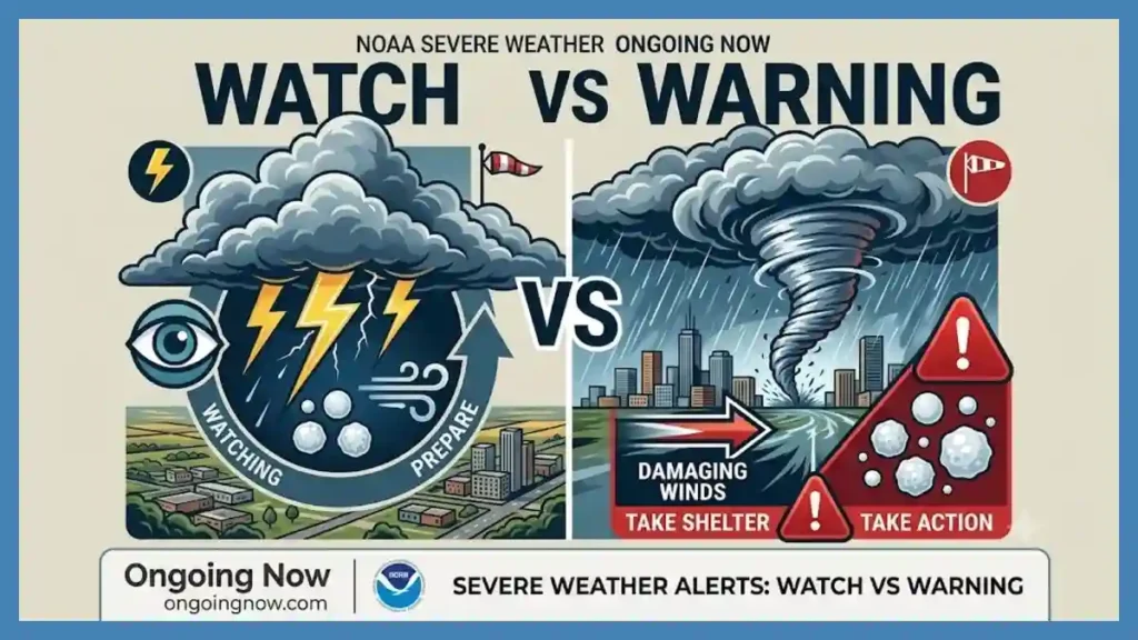
Information Statement: Issued when a significant earthquake occurs in the marine environment, indicating that data is being analyzed but no current threat exists for the target area.
Watch: Indicates that an event has occurred which could potentially affect the region, advising coastal residents to remain alert for subsequent updates as data clarifies.
Advisory: Activated when strong currents or dangerous waves are expected near the immediate shoreline, necessitating the closure of beaches and harbor facilities.
Warning: The highest alert level, indicating that a dangerous, widespread inundation is imminent or occurring, requiring immediate movement to higher ground or upper floors of reinforced structures.
By maintaining these strict operational thresholds, the NWS ensures that public alerts correspond directly to verified physical data, avoiding warning fatigue among coastal residents. Emergency management groups rely on these precise distinctions to deploy resources effectively and coordinate local law enforcement actions along exposed beachfronts.
Maritime Infrastructure and Shallow Water Telemetry
As open-ocean waves approach the shallow waters of the Florida Reef Tract and the continental shelf, their physical characteristics change through a process known as shoaling. In the deep ocean, tsunami waves may only be a few inches high but travel at speeds exceeding 500 miles per hour. When these waves enter shallower zones, their velocity decreases while their amplitude climbs, converting kinetic energy into vertical wave height.
+-------------------------------------------------------------------------+
|                      OCEANIC WAVE SHOALING DYNAMICS                     |
+-------------------------------------------------------------------------+
| OPEN OCEAN (Deep Water)                  SHORELINE (Shallow Water)      |
|                                          _                              |
|                                         / \   <- Amplitude increases    |
| Speed: 500+ mph                        /   \                            |
| Amplitude: Low (Inches)               /     \ Speed drops to 20-30 mph  |
| ------------------------------------/       \-------------------------- |
| ========= CONTINENTAL SHELF RISE ========>   | BEACH INUNDATION ZONE    |
+-------------------------------------------------------------------------+
To capture these shifts before waves reach populated shores, NOAA maintains a grid of Deep-ocean Assessment and Reporting of Tsunamis (DART) buoys. These systems utilize a seafloor pressure sensor that detects changes in the weight of the water column above it, transmitting the data via acoustic telemetry to a surface buoy, which then relays the information to orbiting satellites. This real-time system allows oceanographers to calculate exact wave profiles long before they encounter coastal shallow waters.
Local Preparedness Strategies for Low-Elevation Communities
Because the topography of southern and central Florida features minimal elevation gains, traditional evacuation strategies focusing on moving miles inland are often impractical. Instead, modern mitigation efforts emphasize vertical evacuation within engineered structures that meet modern wind and hydrodynamic force standards. Municipal building codes require waterfront developments to incorporate open ground-floor designs that allow floodwaters to pass through without compromising structural foundations.
Beachfront managers, port authorities, and maritime shipping operators receive specialized training to secure heavy vessels and clear commercial channels when advisory conditions are forecast. Strong currents inside narrow inlets and harbor mouths represent the most common hazard associated with minor seismic surges, making early harbor evacuations an essential component of local coastal resilience protocols.
Evaluating Predictive Models and Sensor Discrepancies
Modern tsunami forecasting relies heavily on numerical models that simulate wave propagation across complex bathymetric profiles. The Method of Splitting Tsunami (MOST) model integrates real-time DART buoy data to project maximum wave heights and arrival times for specific coastal points. While these models are highly accurate in deep water, variations in local reef structures and coastal geometry can introduce minor variations in final shoreline run-up calculations.
“Data validation through paired observation points ensures that localized anomalies do not trigger broader, unnecessary coastal alerts, preserving the integrity of the regional warning system.” — NOAA Center for Tsunami Research
When model discrepancies arise due to sensor calibration issues or localized marine shifts, analysts prioritize direct physical readings over purely theoretical projections. This conservative approach prevents false alarms while ensuring that if a verified anomaly crosses the outer buoy array, local notification systems deploy with maximum lead time.
Long-Term Tectonic Outlook for the Southeast Coast
From a long-term geological perspective, the southeastern coast of the United States remains one of the safest maritime zones globally regarding major tectonic disruptions. The distance separating the Florida peninsula from active subduction zones—such as the Puerto Rico Trench—provides a geographic buffer that dampens the energy of most regional seismic events. Continuous monitoring remains necessary, however, as part of a comprehensive multi-hazard mitigation strategy.
+-----------------------------------------------------------------------------+
|                      REGIONAL SEISMIC MONITORING NETWORK                    |
+-----------------------------------------------------------------------------+
| [USGS Seismometers] ---> [National Tsunami Warning Center] <--- [DART Buoys]|
|                                      |                                      |
|                                      v                                      |
|                        [National Weather Service]                           |
|                                      |                                      |
|            +-------------------------+-------------------------+            |
|            |                                                   |            |
|            v                                                   v            |
|    [Coastal Advisories]                              [Emergency Management] |
|    (Beaches & Harbors)                               (Local Evacuations)    |
+-----------------------------------------------------------------------------+
As coastal populations expand and infrastructure density increases along the Atlantic and Gulf coasts, the reliance on automated sensor data and clear public reporting will grow. By focusing on empirical observations, verified tectonic physics, and coordinated agency communications, the regional emergency framework protects both residents and maritime commerce without resorting to speculative claims or undue alarm.
Stay sharp with Ongoing Now!
—
Source and Data Limitations: This analysis relies exclusively on data provided by the United States Geological Survey (USGS) Earthquake Hazards Program, the National Oceanic and Atmospheric Administration (NOAA) National Tsunami Warning Center, and historical seismic logs from the National Geophysical Data Center. Model projections are based on the Method of Splitting Tsunami (MOST) framework, which updates dynamically following seismic events of magnitude 6.5 or greater within the Caribbean basin. Sensor data accuracy is subject to local bathymetric variations, telemetry transmission speeds, and temporary buoy maintenance cycles. Unverified reports from non-governmental tracking applications or social media platforms regarding local tremor sensations are excluded due to lack of calibration and scientific validation.