Demystifying the Critical Difference Between Watch and Warning Protocols
A definitive meteorological guide to understanding National Weather Service criteria, localized storm tracking data, and essential public safety protocols.
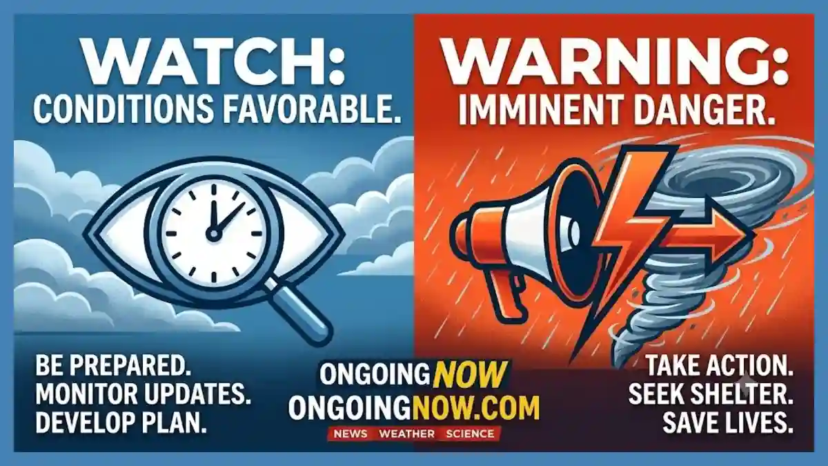
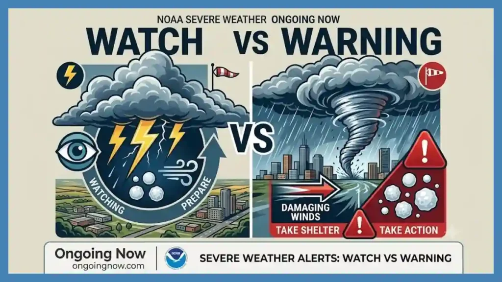
Understanding the difference between watch and warning systems is critical when analyzing an active severe thunderstorm watch today. Knowing the exact severe thunderstorm watch meaning helps communities prepare, outlining what to do during thunderstorm watch periods before hazards emerge. Official NOAA severe thunderstorm alert updates rely on a convective outlook map today to evaluate atmospheric risk tiers. By monitoring a local storm radar live dashboard, meteorologists can identify a damaging wind gusts forecast and issue large hail safety instructions. Utilizing an NWS radar tracking near me tool alongside verified emergency weather radio frequencies ensures individuals can monitor any shifting severe weather threat level in real time as convective systems develop across vulnerable regions.
Effective weather communication requires precision. The National Weather Service (NWS), an operating component of the National Oceanic and Atmospheric Administration (NOAA), serves as the definitive legal authority for issuing these public notifications in the United States. Climatologists and operational forecasters at the Storm Prediction Center (SPC) in Norman, Oklahoma, collaborate continuously with local Weather Forecast Offices (WFOs) to monitor meteorological parameters. Using highly sensitive remote sensing networks, including the Next-Generation Radar (NEXRAD) Doppler system and Geostationary Operational Environmental Satellites (GOES), scientists analyze the thermodynamic structures of the troposphere. The data generated through these tools forms the backbone of community safety plans, preventing injuries and mitigating economic damages by drawing a stark operational distinction between atmospheric potential and imminent physical reality.
The Scientific Definition of a Severe Thunderstorm Watch
A severe thunderstorm watch represents a preventative, long-range assessment of environmental conditions. When the Storm Prediction Center issues a watch, it indicates that the essential raw ingredients for severe convective storms are present within a designated geographic boundary. These elements include high levels of low-level moisture, atmospheric instability driven by steep thermal lapse rates, a lifting mechanism such as a cold front or dryline, and vertical wind shear. Wind shear, which involves variations in wind speed and direction at different altitudes, is critical because it organizes disorganized individual storms into long-lived, severe convective systems.
A watch typically covers a broad spatial area, often encompassing tens of thousands of square miles across multiple counties or states. The operational lifespan of a watch generally spans six to nine hours, providing local emergency management agencies, utility providers, and the general public ample time to implement safety protocols.
“A watch is a call to heightened awareness,” states the NWS Storm Prediction Center operational guidelines. “It does not guarantee that every community within the watch box will experience severe weather, but rather that the thermodynamic environment possesses the capacity to sustain severe convective events if storms initiate.”
During a watch, the primary objective is preparation rather than immediate shelter-seeking. The atmosphere is closely monitored by regional offices using radiosonde soundings (weather balloons) and satellite imagery to observe whether cap inversion layers—zones of warm air aloft that suppress cloud vertical growth—will break, allowing explosive storm development to begin.
Analysis: Deciphering the Operational Mechanics of a Warning
When an alert transitions to a warning, the meteorological paradigm shifts from probabilistic forecasting to real-time verification. A severe thunderstorm warning is issued by a local NWS Weather Forecast Office when a severe storm is either observed by a certified storm spotter or indicated via dual-polarization Doppler radar. Unlike the expansive grid of a watch, a warning is highly targeted. It utilizes a storm-centric polygon system that delineates the precise path of the convective cell, ignoring political boundaries like county lines to focus purely on the physics of the storm’s trajectory.
Warnings are short-duration alerts, typically lasting 30 to 60 minutes. The issuance of a warning means that the threat is active, immediate, and localized. The criteria used by the NWS to define a severe thunderstorm are strictly bound by measurable physical thresholds:
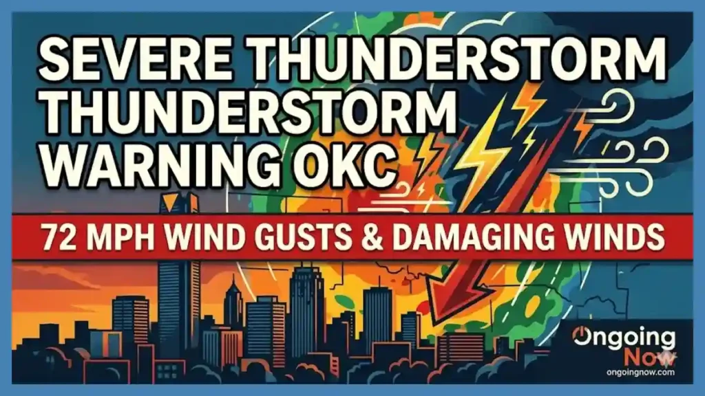
Damaging Winds: Wind gusts measured or estimated at 58 miles per hour (50 knots) or greater.
Large Hail: Atmospheric ice pellets measuring 1 inch in diameter or larger (equivalent to the size of a standard U.S. quarter).
Tornado Potential: Convective systems showing significant rotation that may rapidly generate tornadoes.
It is important to emphasize that lightning frequency and total rainfall accumulation are explicitly excluded from severe thunderstorm warning criteria. A storm may produce exceptional, continuous cloud-to-ground lightning and torrential downpours, but if it lacks the specified wind or hail thresholds, it is classified as a heavy, non-severe thunderstorm. Excessive rainfall is handled under a distinct operational architecture via Flash Flood Watches and Warnings.
Interpreting the Multi-Tiered Severe Weather Threat Level
To communicate the severity of expected storm environments effectively, the Storm Prediction Center utilizes a five-tier risk scale within its daily convective outlook. This system ranks the convective threat based on statistical probabilities of severe weather occurring within 25 miles of any given point inside a risk zone. Understanding this scale allows agricultural operators, industrial managers, and municipal safety teams to scale their responses proportionally.
Clean Newsroom Grid: The Five Categories of Convective Risk
| Risk Level | Visual Category | Statistical Probability | Primary Environmental Characteristics |
| Level 1 | Marginal (MRGL) | 2% – 5% | Isolated severe storms; short duration; limited organization. |
| Level 2 | Slight (SLGT) | 15% | Scattered severe storms; short-lived but intense cells possible. |
| Level 3 | Enhanced (ENH) | 30% | Widespread severe storms; multi-cell clusters or squall lines likely. |
| Level 4 | Moderate (MDT) | 45% | Long-lived severe storms; widespread damage; intense supercells. |
| Level 5 | High (HIGH) | 60% or higher | Extreme severe weather outbreak; derechos or major tornado families. |
Note: Probabilities represent the likelihood of a severe weather event occurring within 25 miles of a specific location inside the designated tier area.
When the risk profile reaches Level 4 or Level 5, the threat to life and property intensifies significantly. In rare cases where long-lived, high-impact straight-line winds (derechos) or massive hail events are forecast with high confidence, the SPC may issue a Particularly Dangerous Situation (PDS) Severe Thunderstorm Watch. This specialized alert wording is reserved for atmospheric setups capable of generating winds exceeding 75 to 90 miles per hour, sufficient to cause structural failure in standard residential buildings and down high-voltage transmission lines.
Why This Matters: The Societal and Structural Impact of Severe Convection
The physical forces unleashed by severe convective events have profound economic and structural implications. Straight-line winds, which are often caused by powerful downdrafts known as downbursts or microbursts, are frequently mistaken for tornadoes due to the magnitude of the resulting damage. When cold, dense air drops rapidly from the upper levels of a thunderstorm, it slams into the ground and spreads out horizontally. These winds can accelerate to over 100 miles per hour, destroying commercial roofing assemblies, uprooting mature trees, and flipping unanchored structures.
The economic toll of large hail is equally severe, impacting the agricultural, automotive, and real estate sectors. When strong updrafts within a supercell carry water droplets upward into freezing atmospheric layers, they form ice pellets. As these pellets cycle through the updraft, layers of supercooled water freeze onto them, allowing the hail to grow. A 1-inch hailstone falls at roughly 25 to 40 miles per hour, which is sufficient to destroy field crops and dent vehicles. When hailstones reach 2 inches or larger, their terminal velocity increases to over 40 to 70 miles per hour, easily piercing asphalt shingles, smashing windows, and fracturing concrete tiles.
From a public health perspective, the transition from a watch to a warning is the critical window where human behavior directly dictates survival rates. According to historical data from the National Center for Health Statistics, a significant percentage of severe weather injuries occur not from direct exposure to the storm, but from secondary impacts, such as flying debris, falling trees striking occupied vehicles, or structural collapses caused by sustained wind loading. By formalizing actionable timelines through the watch and warning framework, emergency management agencies give communities a structured window to minimize exposure.
Technical Calibration: Radar Interpretation and Remote Sensing
Modern meteorology relies on a complex network of ground-based radar installations to track storm features. The NEXRAD system transmits electromagnetic waves that reflect off hydrometeors (rain, hail, snow). By measuring the frequency shift of the returned signal, the radar calculates the velocity of the particles moving either toward or away from the radar antenna. This data provides operational forecasters with real-time insights into the internal dynamics of a convective cell.
Forecasters look for specific signatures to identify severe threats:
Hook Echo: A pendant-like extension on the right-rear flank of a storm, signifying that rain and hail are wrapping around the storm’s updraft, a strong indicator of supercell organization and potential tornadogenesis.
Bounded Weak Echo Region (BWER): A localized zone within a storm where radar reflectivity is low aloft, surrounded by higher reflectivity. This indicates an exceptionally powerful updraft that is carrying moisture upward so quickly that it prevents precipitation from forming until it reaches high altitudes.
Bow Echo: A crescent-shaped line of radar reflectivity that indicates a powerful rear-inflow jet of air pushing the center of a squall line outward. Bow echoes are primary indicators of impending destructive straight-line winds.
In addition to reflectivity, meteorologists utilize Correlation Coefficient (CC) products. This dual-polarization capability allows the radar to compare the horizontal and vertical dimensions of objects in the air. A sudden drop in CC indicates non-uniform particles, which helps forecasters identify a debris ball (lofting of structural material by a tornado) or distinguish large, irregular hailstones from uniform raindrops.
Actionable Safety Protocols and Communication Redundancy
When monitoring convective hazards, creating communication redundancy is vital. Reliance on a single information path, such as cellular networks, introduces significant points of failure during severe weather events. High-velocity winds and lightning strikes frequently disable cellular towers, interrupt commercial electrical grids, and sever fiber-optic internet lines, leaving digital applications non-functional.
“True emergency preparedness requires independent communication channels,” explains Dr. Aris Vance of the Atmospheric Research Consortium. “When local power grids fail, a dedicated weather radio operating on backup battery power remains the single most reliable link between operational meteorologists and the public.”
Safety Instructions for Convective Alerts
Establish a Primary Receiver: Maintain an emergency weather radio calibrated to the correct regional Specific Area Message Encoding (SAME) frequency. This device remains functional via battery power even during full grid failures.
Execute Structural Sheltering: Upon the issuance of a warning, immediately abandon temporary structures, mobile homes, and tents. Seek shelter inside a permanent building, moving to the lowest level or an interior, windowless room.
Mitigate Projectile Risks: Secure loose outdoor items such as patio furniture, refuse containers, and landscaping tools during a watch. These items quickly become dangerous projectiles when exposed to severe downdrafts.
Disconnect Electronics: Power surges from nearby cloud-to-ground lightning strikes can bypass standard surge protectors. Unplug sensitive diagnostic equipment and major appliances before the storm arrives.
If you are caught driving when a severe thunderstorm warning takes effect, you must modify your operations immediately. Heavy rain and large hail drastically reduce visibility, making safe driving impossible. Do not park your vehicle under highway overpasses; this creates a dangerous traffic hazard and can actually increase wind speeds due to a venturi (funneling) effect beneath the bridge structure. Instead, find a safe location away from trees and power lines, keep your seatbelt fastened, and position your face away from the windows to protect against flying glass if hail shatters the windshield.
Evidence-Based Insights: Historical Precedents and Climate Context
Evaluating historical convective data reveals clear long-term trends in how severe weather affects infrastructure. Climatological baselines compiled by NOAA show that while the overall annual frequency of severe thunderstorms across the continental United States has remained relatively stable over the past several decades, the spatial distribution and clustering of these events have shifted. The historical region of high frequency, traditionally known as “Tornado Alley” in the Great Plains, has expanded, showing noticeable increases in severe convective activity across the Mississippi Valley, the Midwest, and the Southeast.
This geographic shift increases the vulnerability of human populations. The Southeast and Midwest feature higher population densities, more expansive urban layouts, and a greater percentage of manufactured housing units compared to the open plains of West Texas or Western Kansas. Consequently, a convective system producing 70-mile-per-hour winds or golf-ball-sized hail in these eastern zones results in significantly higher economic losses and greater strains on local emergency response systems.
Furthermore, long-term climate datasets indicate an increase in the number of days with high Convective Available Potential Energy (CAPE)—a metric that measures the amount of buoyancy available to accelerate a rising parcel of air. Higher CAPE values are driven by increased surface temperatures and elevated atmospheric moisture content, providing the energetic foundation for more explosive storm development. When these highly unstable environments interact with shifting jet stream patterns, the resulting storms can exhibit greater organization, leading to larger hail sizes and more expansive straight-line wind damage. Understanding the distinction between a watch and a warning remains the primary tool for individual and community defense against these shifting environmental hazards.
Stay sharp with Ongoing Now!
Source and Data Limitations: This explainer relies on the official operational definitions, thresholds, and warning criteria established by the National Weather Service (NWS) and the NOAA Storm Prediction Center (SPC). Historical convective trends and statistical risk parameters are derived from peer-reviewed findings published by the American Meteorological Society (AMS) and long-term climate assessments from the National Centers for Environmental Information (NCEI). All radar signatures and interpretation guidelines are based on standard Doppler NEXRAD operational training protocols. This text is an educational tool and does not provide real-time radar tracking or localized alert feeds. Users must consult local NWS offices, NOAA weather radio frequencies, and regional emergency management authorities for live, site-specific safety alerts and active storm declarations.