Oahu Flash Flood Warning: Critical Dam Risks and Evacuations
Rising water levels at Wahiawa Dam prompt North Shore evacuation zones as the Hawaii National Guard deploys to assist thousands.
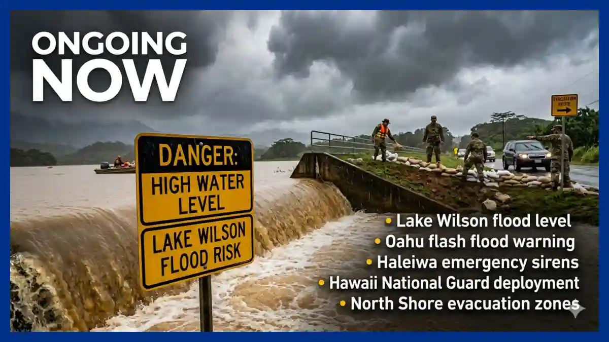
The Oahu flash flood warning issued by the National Weather Service (NWS) on March 20, 2026, has escalated into a major public safety operation as over 4,000 residents face mandatory displacement. A second consecutive “Kona low” storm system has pushed the 120-year-old Wahiawa Dam to critical capacity, leading the Honolulu Department of Emergency Management to issue “Leave Now” alerts for the towns of Waialua and Haleiwa. Hawaii Governor Josh Green confirmed a Hawaii National Guard deployment to support local fire and rescue teams as muddy floodwaters inundate streets and threaten to overtop the dam’s spillway.
The current situation remains fluid, with emergency sirens blaring across the North Shore to warn of a potential dam breach map scenario that could send catastrophic volumes of water through the Kaukonahua Stream. As of early March 21, Lake Wilson flood level readings remain near the 85-foot spillway threshold, leaving downstream communities in a precarious state of high-alert status.
The Immediate Threat to North Shore Communities
Regional emergency officials shifted from advisory to mandatory action early Friday morning when rainfall rates reached 1 to 2 inches per hour over already saturated soil. The primary concern is the integrity of the Wahiawa Dam, a structure built in 1906 originally intended for sugar cane irrigation. While the dam has not failed, the Honolulu Department of Emergency Management (DEM) reported it is at “imminent risk” of failure due to the sustained hydraulic pressure of Lake Wilson.
Waialua flooding updates indicate that chest-high water has already swept through low-lying residential sectors, forcing some residents to flee via bulldozers and jet skis. The NWS Flash Flood Warning remains in effect as the runoff from the interior mountains continues to feed the reservoir. Officials emphasize that the speed of a potential breach leaves zero margin for delay, particularly for those within the identified North Shore evacuation zones.
Hawaii National Guard and Emergency Response
Governor Josh Green’s activation of the Hawaii National Guard underscores the severity of the institutional response. Guard members are currently assisting the Honolulu Police Department and Honolulu Fire Department with high-water rescues and the establishment of temporary shelters. However, the response has faced logistical hurdles; a primary shelter at Waialua High and Intermediate School was itself forced to evacuate on Friday due to encroaching floodwaters.
The Honolulu Department of Emergency Management alerts have consistently urged residents to carpool to mitigate heavy traffic on the limited exit routes out of the North Shore. The strategic deployment of the National Guard includes heavy equipment and personnel trained in disaster logistics to maintain these transit corridors and provide medical support to those displaced.
By the Numbers: March 2026 Flood Data
The following table outlines the critical thresholds and current figures as reported by the U.S. Geological Survey (USGS) and local emergency agencies.
| Metric | Current Status (March 21, 2026) | Critical Threshold |
| Lake Wilson Flood Level | ~84.8 Feet | 85.0 Feet (Spillway Level) |
| Evacuation Count | 4,000+ Residents | N/A |
| Rainfall Intensity | 1–2 Inches / Hour | High Risk > 0.5 Inch / Hour |
| Dam Age | 120 Years | High Risk (Aging Infrastructure) |
| National Guard Status | Fully Activated | N/A |
Infrastructure Vulnerability: The Wahiawa Dam
The threat of a dam breach map becoming a reality has reignited long-standing debates regarding Hawaii’s aging infrastructure. The Wahiawa Dam (Lake Wilson) is classified as a high-hazard potential dam, meaning a failure would likely result in the loss of human life. History provides a somber precedent: in 2006, the Ka Loko Dam breach on Kauai killed seven people, a tragedy that officials are desperate to avoid repeating.
Current Haleiwa emergency sirens serve as a stark reminder of the technical limitations of these older earthen structures. While modern dams are built with reinforced concrete and sophisticated drainage, the Wahiawa Dam relies heavily on its spillway to manage excess volume. When the spillway is overtopped, the risk of erosion at the dam’s base—leading to a total structural collapse—increases exponentially.
Regional and National Policy Implications
This event follows a similar storm just one week prior, highlighting a pattern of increasing climate volatility in the Pacific. Domestic policy analysts note that the frequent activation of the Hawaii National Guard for weather-related events is straining local budgets and raising questions about federal infrastructure grants. The “Kona low” phenomenon, while natural, is occurring with a frequency and intensity that tests the limits of the Honolulu Department of Emergency Management alerts system.
Legislative focus is likely to shift toward the Department of Land and Natural Resources (DLNR), which oversees dam safety. Federal funding through the Infrastructure Investment and Jobs Act (IIJA) has been earmarked for dam safety nationally, but the specific rehabilitation of private or legacy irrigation dams remains a complex legal and financial hurdle for the state government.
Analysis: Why the Next 24 Hours are Critical
The “touch-and-go” nature of the current flooding, as described by Governor Green, stems from the saturation of the watershed. Even if rainfall ceases temporarily, the “lag time” between mountain runoff and reservoir rising means the Lake Wilson flood level may continue to climb for several hours.
Hydraulic Stabilization: If the water remains below the 85-foot mark, engineers may be able to slowly release pressure once the storm passes.
Structural Integrity: The primary fear is not just the volume of water, but the stability of the 120-year-old embankment under unprecedented saturation.
Public Compliance: Emergency managers are concerned about “evacuation fatigue,” where residents might attempt to return to their homes before the official “all clear” is given.
Impact on the North Shore Community
Beyond the immediate physical danger, the flooding has significant social and economic consequences. The North Shore is an international hub for surfing and tourism, but the current Oahu flash flood warning has effectively shuttered the regional economy. Small businesses in Haleiwa report significant property damage, and the loss of vehicles—the primary mode of transport for many workers—will have a lingering impact on the local labor market.
Human-centric reporting from the ground highlights a community in a state of shared anxiety. Kathleen Pahinui, a resident of Waialua, noted that the aging dam is a recurring fear for the community. “Just pray for us,” she stated during the evacuation process. “We understand there’s more rain coming.” This sentiment reflects a broader national trend where residents in rural or geographically isolated areas feel increasingly vulnerable to the failure of legacy infrastructure.
Comparative Historical Context
When compared to the 2006 Kauai breach or the 2021 flooding in the same region, the March 2026 event is notable for the scale of the preventative evacuation. In previous years, orders were often issued after significant damage had occurred. The current proactive stance of the Honolulu Department of Emergency Management demonstrates a shift in policy toward over-communication and early mobilization of the Hawaii National Guard to prevent loss of life at any cost.
Looking Ahead: Recovery and Preparedness
As the Kona low storm system begins to depart north early next week, the focus will transition from rescue to recovery. However, the NWS warns that high streams and standing water will remain a hazard through the weekend. Residents are advised to monitor the official Waialua flooding updates and HNL Info alerts before attempting to re-enter evacuation zones.
The long-term resolution will require more than just sandbags and sirens. It will demand a comprehensive federal and state re-evaluation of the North Shore’s flood mitigation systems, including the potential decommissioning or total reconstruction of the Wahiawa Dam to meet 21st-century safety standards.
Stay sharp with Ongoing Now!
Source and Data Limitations: This report is based on official updates from the National Weather Service (NWS) Honolulu, the Honolulu Department of Emergency Management (DEM), and the U.S. Geological Survey (USGS) water gauge data (Station 16210000) current as of March 21, 2026. Supporting information includes public statements from Governor Josh Green and reports from the Hawaii Emergency Management Agency (HI-EMA). Data regarding the 1906 construction of the Wahiawa Dam and the 2006 Kauai breach are derived from historical state records. Some property damage figures remain provisional as emergency teams are still in the active rescue phase. Claims regarding the “imminent risk” of failure were sourced directly from the HNL Alert system issued at 09:00 AM on March 20, 2026.